
GIS-grade field data collection, built by GIS people.
Capture polygons, lines and points to survey standards, with snapping, topology and GPS quality rules you set in the browser. Teams collect on Android and iOS, with or without network. Every feature lands on a live map and in your GIS, with who captured it, where, and when.
- Polygons, lines and points with topology
- Snapping, streaming, RTK receivers
- PostGIS, QGIS, shapefile, GeoPackage
- Offline first, EUDR-ready
What most data capture tools leave out
Form-first tools were built for questionnaires, with a map added later. PreciseCapture was built for the map, by a GIS consultancy that has spent years in the field. These are the differences your data will show.
| Capability | Typical form tools | PreciseCapture |
|---|---|---|
| Geometry | A pin on a map, or a shape drawn by hand. | Polygons, lines and points to survey standards: snap to neighbours, stream GPS as you walk, move and insert corners, with live area in hectares. |
| Quality checks | Required fields and a date. | GPS accuracy gates, minimum and maximum area, self-intersection, overlap and duplicate checks on the phone before upload. Fake-GPS apps are refused. |
| Who sets the rules | The collector, in the app's settings. | You, in the browser: rules at organisation, project and layer level, locked so collectors cannot change them. |
| Existing data | Every project starts from a blank form. | Start from your shapefile, GeoPackage or geodatabase. Collectors verify and update the records in the field, and you export back in the same format. |
| Context layers | None, or a basemap at best. | Forest reserves, concessions and administrative boundaries as read-only layers, with spatial rules that flag or block a feature inside them. |
| Repeat visits | A new submission each time, unconnected to the last. | Rounds and observation layers: the same farm or facility visited every season, with changes flagged and coverage tracked. |
| Evidence | A submission timestamp. | Who captured each record, on which device, when, and every later change. Managers approve or send back with a note. |
| Where the data goes | A CSV download. | A live vector-tile map, shapefile, GeoPackage, KML, GeoJSON and Excel exports, a PostGIS connection, a REST API, and your own servers if you prefer. |
A GIS first, a form builder second
Most collection apps bolt a map onto a questionnaire. PreciseCapture starts from the geometry: real feature classes, spatial rules, computed measurements, and outputs that drop straight into QGIS, ArcGIS or your spatial database.
Feature classes, not forms with a pin
Each layer has a geometry type, its own attribute schema and capture rules. Polygon farms, line footpaths, point water sources and record-only registers live side by side in one project.
Topology on capture
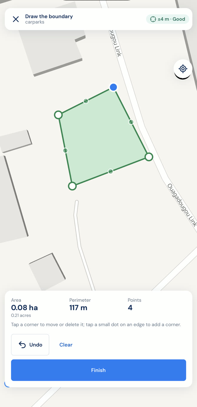
Snap new vertices to neighbouring boundaries, refuse self-intersections, catch overlaps against your own layer or a reference layer, and flag duplicates by centroid distance.
Measurements in metres and hectares
Area, perimeter and length are computed on the geography, never in degrees. Centroids, acres and hectares are ready for exports and reports.
Reference layers and spatial rules
Load forest reserves, concessions or administrative boundaries as read-only layers. Rules flag, warn or block a feature that falls inside them, on the phone and on the server.
Vector tiles at scale
The web map is served as vector tiles from PostGIS, so a hundred thousand farms stay fast. Symbolise by attribute, label, hatch and filter like a desktop GIS.
Standards all the way through
WGS 84 on the wire, shapefile, GeoPackage, KML and GeoJSON out, a live PostGIS table in, and an OpenAPI-documented REST API.
From a blank project to a reviewed dataset in three steps
The same model that made GIS Cloud and Mergin Maps work for survey teams, built for the realities of fieldwork in Africa: patchy network, low-end Android phones, and data that has to hold up to audit.
-
Set up in the browser
Create a project, add layers with the geometry they need, build the form with required fields, lists and skip logic, and set the capture rules: GPS accuracy limits, streaming interval, snapping, minimum and maximum area, overlap checks.
-
Collect on the phone, offline
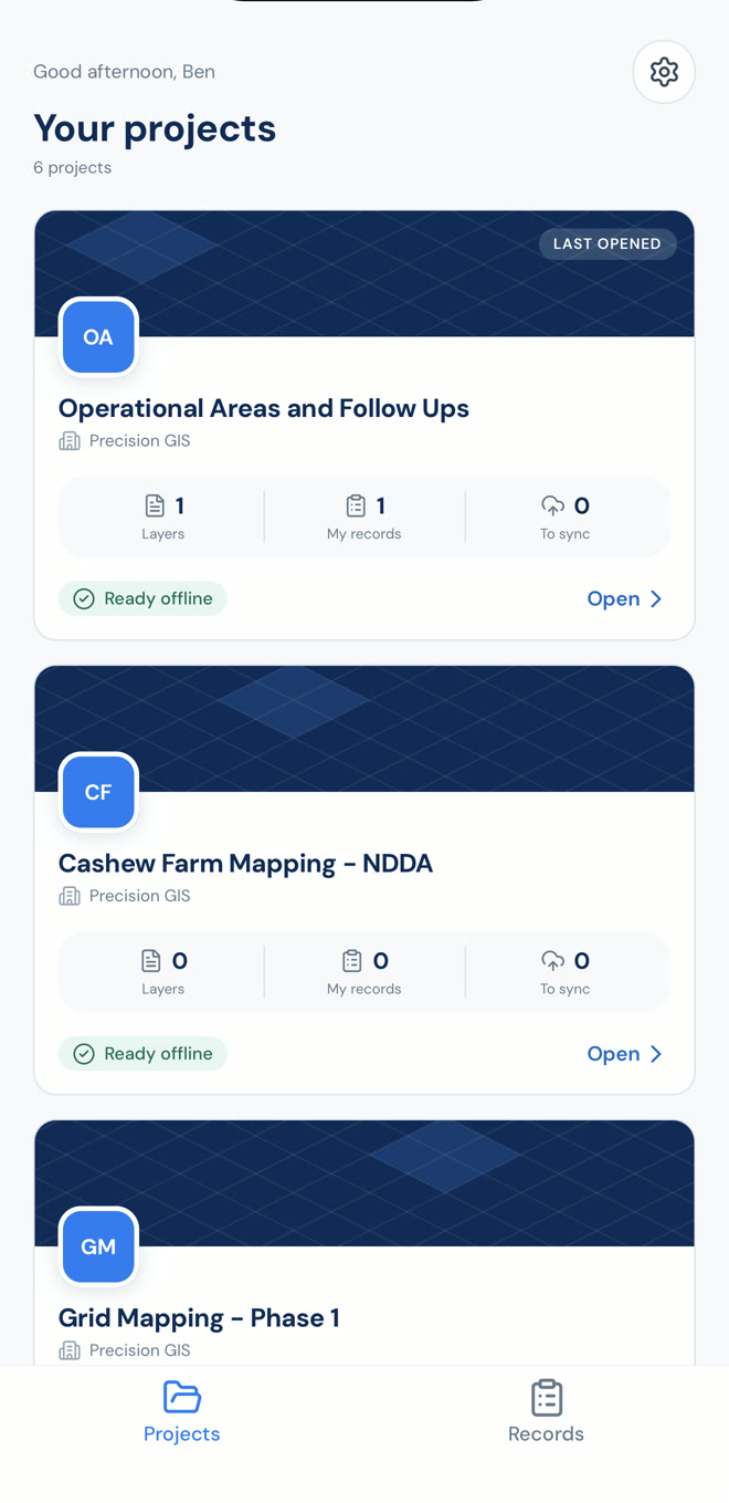
Collectors download the project once, with basemap tiles for the area. They walk boundaries, tap corners or stream GPS, fill the form and take photos. Fake-GPS apps are refused on the device. Sync happens when a network appears.
-
Review and share
Managers see every record on the live map with its quality flags, approve or send it back with a note, resolve conflicts, and export to GeoJSON, shapefile, GeoPackage, KML, CSV or Excel. Or let the data flow straight into your PostGIS database.
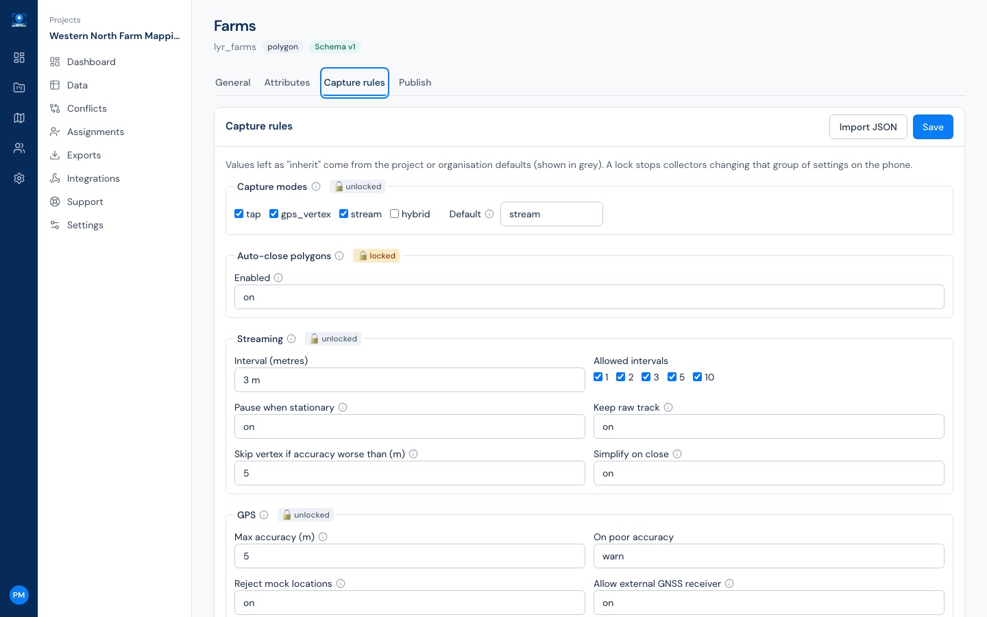
Define your own data capture rules
Every behaviour of the phone is a setting you control, from the organisation down to a single layer, and you can lock it so collectors cannot change it.
- Tap, GPS vertex, streaming or hybrid capture, with GPS averaging per corner
- Accuracy gates that skip bad fixes under canopy instead of recording them
- Snapping to neighbouring boundaries so farms share an edge, with no slivers
- Minimum and maximum area, self-intersection and overlap rules that flag, warn or block
- External GNSS and RTK receivers over Bluetooth when centimetres matter
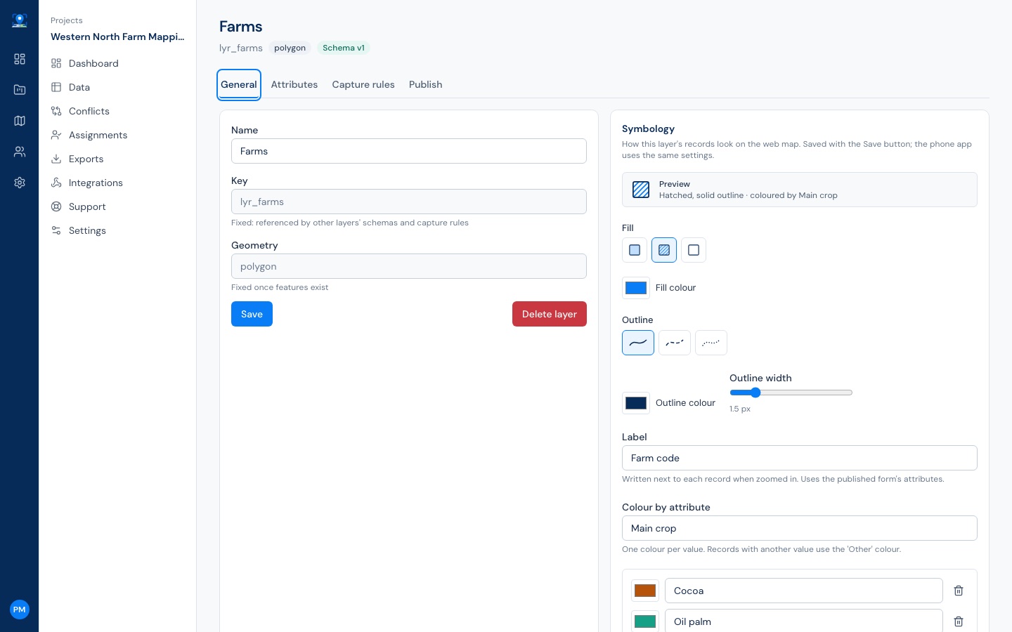
A map your whole team reads at a glance
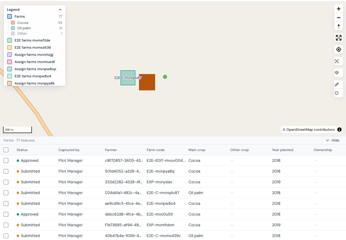
Style each layer the way a GIS analyst would: marker shapes, dashed outlines, hatching, labels, and colour by any attribute with a legend that counts records per class.
- Filter by any attribute or by area, collector and date; the map and the table follow together
- Vector tiles that stay fast at a hundred thousand farms, with you deciding the zoom where shapes appear
- Measure, switch basemaps, read coordinates, zoom to the project area: the controls GIS users expect
- Managers create and correct records on the web, with the same rules the phone enforces
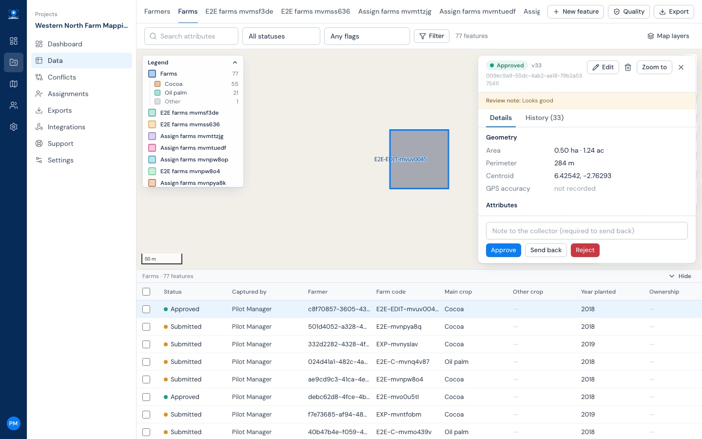
Every record says who captured it, when, and what changed
Payments, certification and disputes all come down to evidence. PreciseCapture keeps the creator, the device, the capture time and a version-by-version history for every record, and shows them by name.
- Approve, reject or send back with a note; bulk review when the data is clean
- Quality flags on the record: poor accuracy, overlaps, duplicates, area outliers, protected-area intersections
- Collectors see each other's work but can only change their own; conflicts are shown side by side
- Deletes are reversible, layers can be archived, and nothing leaves the audit trail
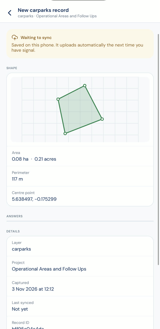
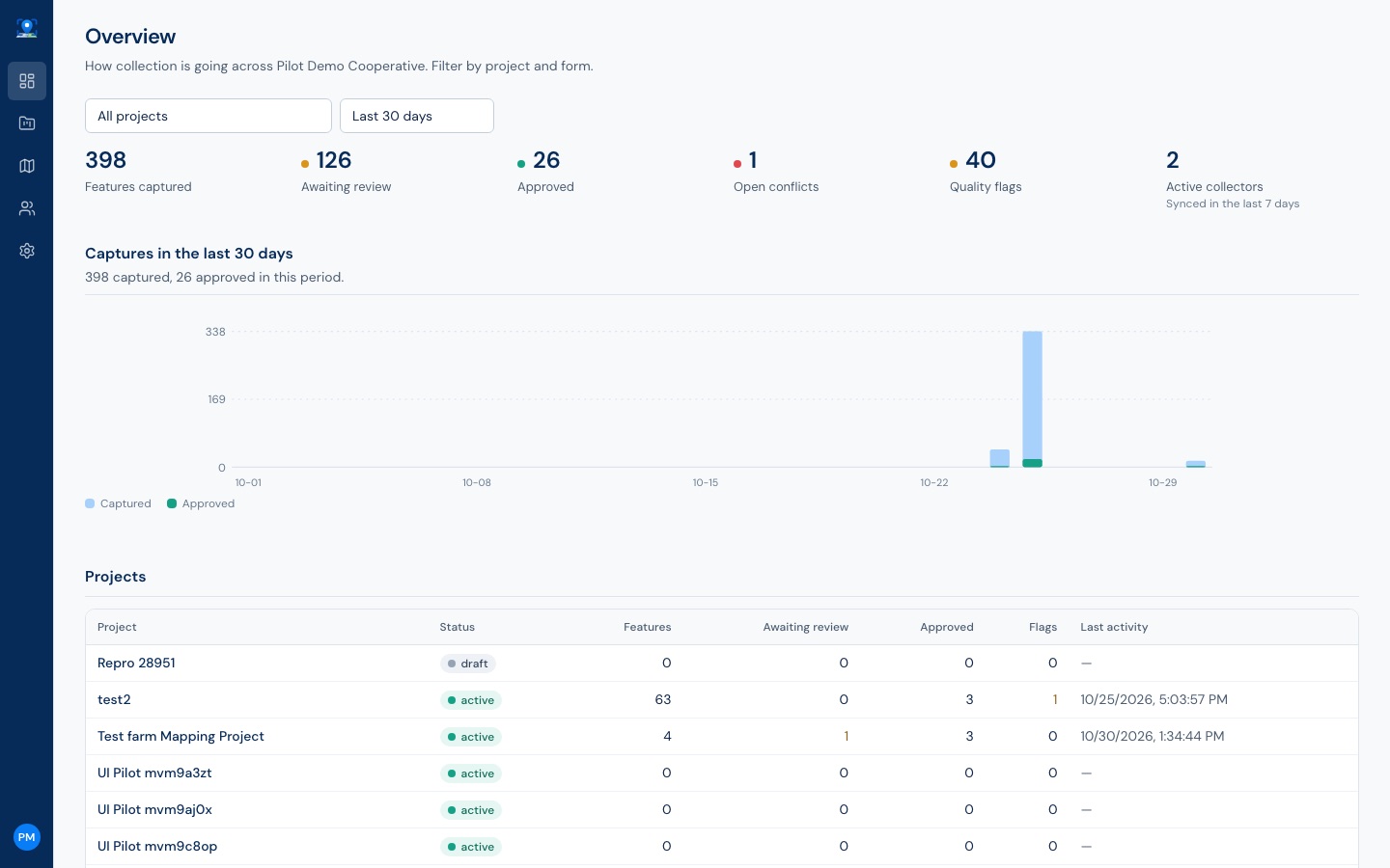
Know how collection is going before the week is out
An organisation overview and a dashboard per project: records captured and approved by day, open conflicts, quality flags, and which collectors have synced in the last seven days.
Built with the EU Deforestation Regulation in view
Exporters of cocoa, coffee, oil palm, rubber and other commodities must supply the geolocation of every plot. PreciseCapture produces the geolocation evidence; your due diligence process does the rest.
The EUDR GeoJSON export applies the size rule for you: a polygon for plots above four hectares, a point allowed below. Plots that break the rule are counted and reported, never silently dropped.
Your data, in the tools you already use
Nothing is locked in. Exports open in QGIS and Excel, and the API, webhooks and database connector keep other systems in step.
PostGIS connector
A typed table per layer in your own PostGIS database, kept in sync as records change. Query it, join it, map it in QGIS.
Scheduled exports
GeoJSON, shapefile, GeoPackage, KML, CSV or Excel delivered to your S3 bucket or SFTP server on a schedule.
Webhooks
Signed notifications when a record is created, reviewed or a conflict opens, with retries and a replay button.
REST API
Everything the web app does, behind organisation API keys with a role cap and project scope. OpenAPI documented.
Start from existing data
Import a shapefile, GeoPackage or geodatabase and send teams out to verify, update or mark plots not found.
DHIS2, Power BI, GhanaPostGPSPlanned
Connectors on the roadmap for health programmes, reporting and Ghana's digital address system.
Hosted by us, or on your own servers
The same software runs in our cloud and on a client's own infrastructure. Government and NGO clients who must keep data in-country can.
PreciseCapture Cloud
We set up your organisation and you invite your team. We run the servers, backups and updates. Each organisation's data is isolated at the database level.
Self-hosted
Docker images for the API, web app and workers, with PostgreSQL and PostGIS, object storage and a tile server. Deploy on your own cloud account or in your data centre.
Put your field teams on PreciseCapture
Tell us about your programme and we will walk you through PreciseCapture on your own use case, then set up a pilot with your team.
Talk to us
Phone(233) 20 319 1590
Emailinfo@precisiongistech.com
OfficeM285 Marias St, Haatso-Bohye
Accra, Ghana